Map of Texas Cities - Texas Road Map

Texas /ˈtɛksəs/ (Spanish: Texas or Tejas
[ˈtexas]) is the second most populous and second largest state of the United
States of America. Geographically located in the south central part of the
country, Texas shares an international border with Mexico to the south and
borders the U.S. states of New Mexico to the west, Oklahoma to the north,
Arkansas to the northeast, and Louisiana to the east. Texas has an area of
268,820 square miles (696,200 km2) and a growing population of over 27.5
million residents (July 2015).[8]
Houston is the largest city in Texas and
the fourth-largest in the United States, while San Antonio is the second
largest in the state and seventh largest in the United States. Dallas–Fort
Worth and Greater Houston are the fourth and fifth largest United States
metropolitan statistical areas, respectively. Other major cities include El
Paso and Austin, the state capital. Texas is nicknamed the Lone Star State to
signify Texas as a former independent republic, and as a reminder of the
state's struggle for independence from Mexico. The "Lone Star" can be
found on the Texan state flag and on the Texan state seal.[9] The origin of the
state name, Texas, is from the word, "Tejas", which means 'friends'
in the Caddo language.[10]
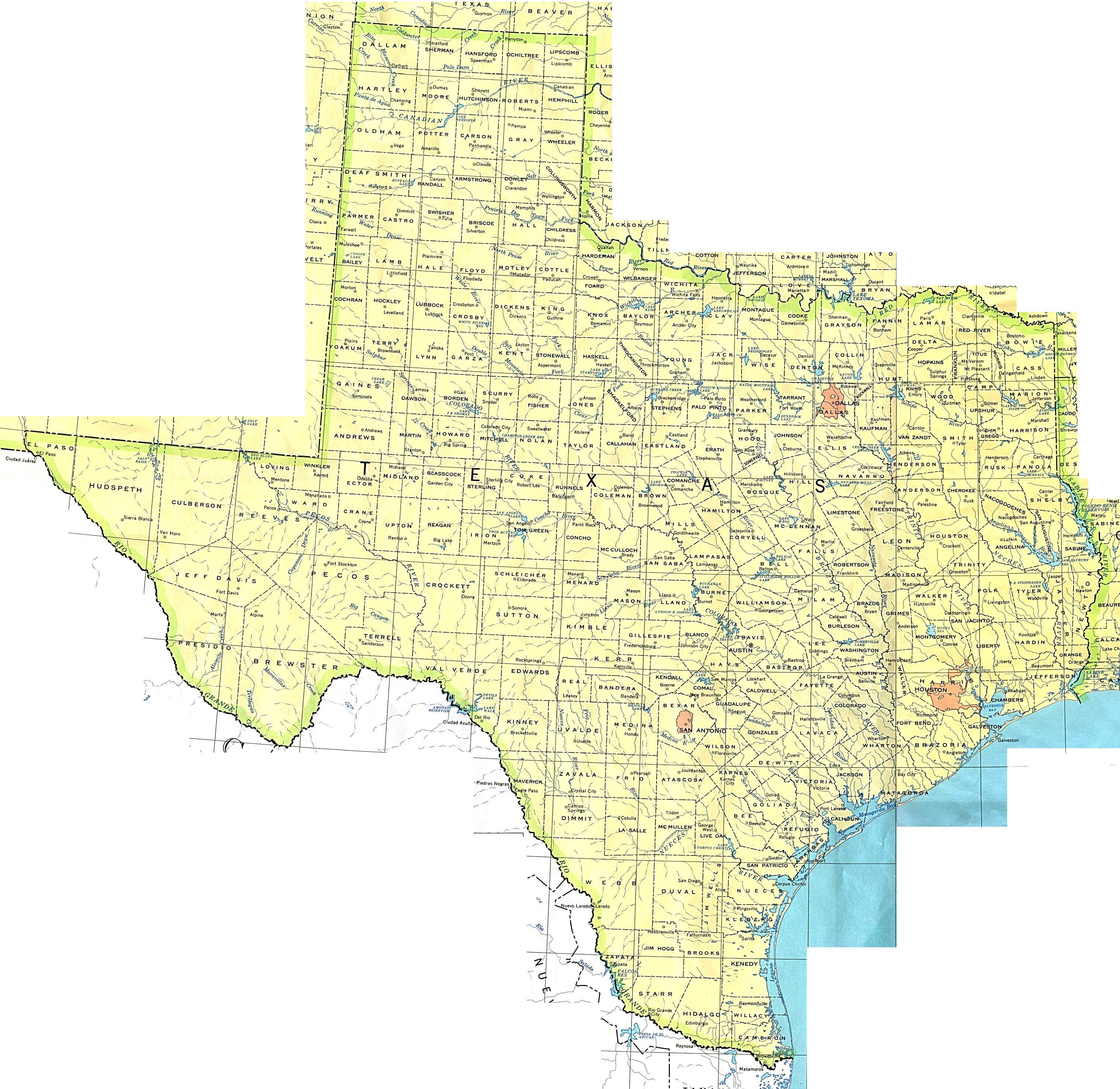
Texas Maps - Perry-Castañeda Map Collection - UT Library Online
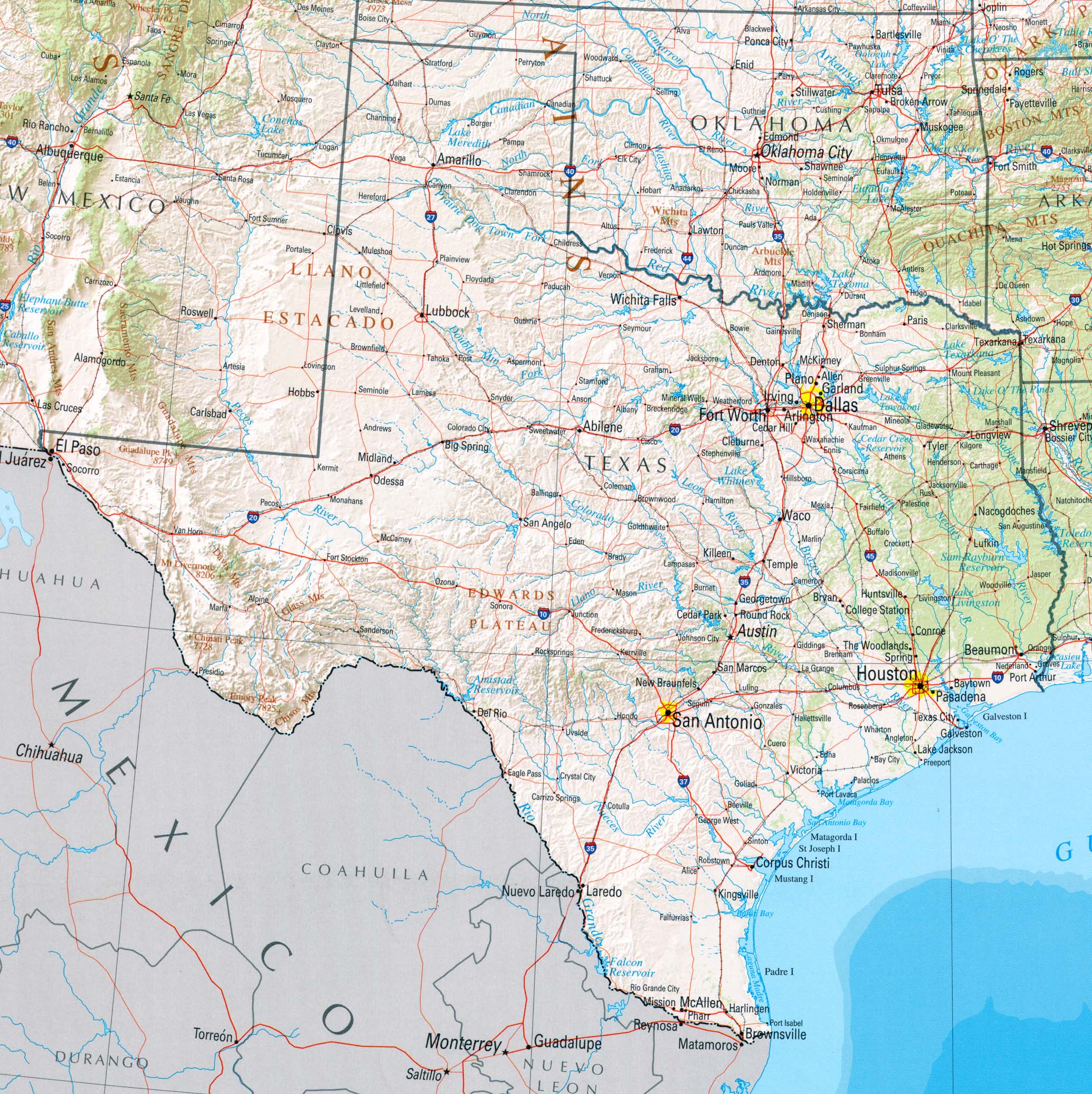
Due to its size and geologic features such as the Balcones Fault, Texas contains diverse landscapes that resemble both the American South and Southwest.[11] Although popularly associated with the Southwestern deserts, less than 10 percent of Texas' land area is desert.[12] Most of the population centers are located in areas of former prairies, grasslands, forests, and the coastline. Traveling from east to west, one can observe terrain that ranges from coastal swamps and piney woods, to rolling plains and rugged hills, and finally the desert and mountains of the Big Bend.
The term "six flags over Texas"[note 1] refers to several nations that have ruled over the territory. Spain was the first European country to claim the area of Texas. France held a short-lived colony in Texas. Mexico controlled the territory until 1836 when Texas won its independence, becoming an independent Republic. In 1845, Texas joined the United States as the 28th state. The state's annexation set off a chain of events that caused the Mexican–American War in 1846. A slave state, Texas declared its secession from the United States in early 1861, and officially joined the Confederate States of America on March 2 of the same year. After the consequent Civil War and the restoration of its representation in the federal government, Texas entered a long period of economic stagnation.
One Texas industry that thrived after the Civil War was cattle. Due to its long history as a center of the industry, Texas is associated with the image of the cowboy. The state's economic fortunes changed in the early 20th century, when oil discoveries initiated an economic boom in the state. With strong investments in universities, Texas developed a diversified economy and high tech industry in the mid-20th century. As of 2010 it shares the top of the list of the most Fortune 500 companies with California at 57.[13] With a growing base of industry, the state leads in many industries, including agriculture, petrochemicals, energy, computers and electronics, aerospace, and biomedical sciences. Texas has led the nation in export revenue since 2002 and has the second-highest gross state product.
Reference Map of Texas, USA - Nations Online Project

Texas Maps - Perry-Castañeda Map Collection - UT Library Online

Texas Maps - Perry-Castañeda Map Collection - UT Library Online
Map of Texas

Texas Map | Map of Texas (TX)


Texas Map | Map of Texas
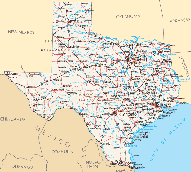
Map of Texas Highways | Tour Texas

Map of Texas Cities And Counties • Mapsof.net
Political Map of Texas - Ezilon Maps

texas.jpg

Map of Texas

Texas County Map | Texas Counties

File:Texas flag map.svg - Wikimedia Commons

Geographical Map of Texas and Texas Geographical Maps

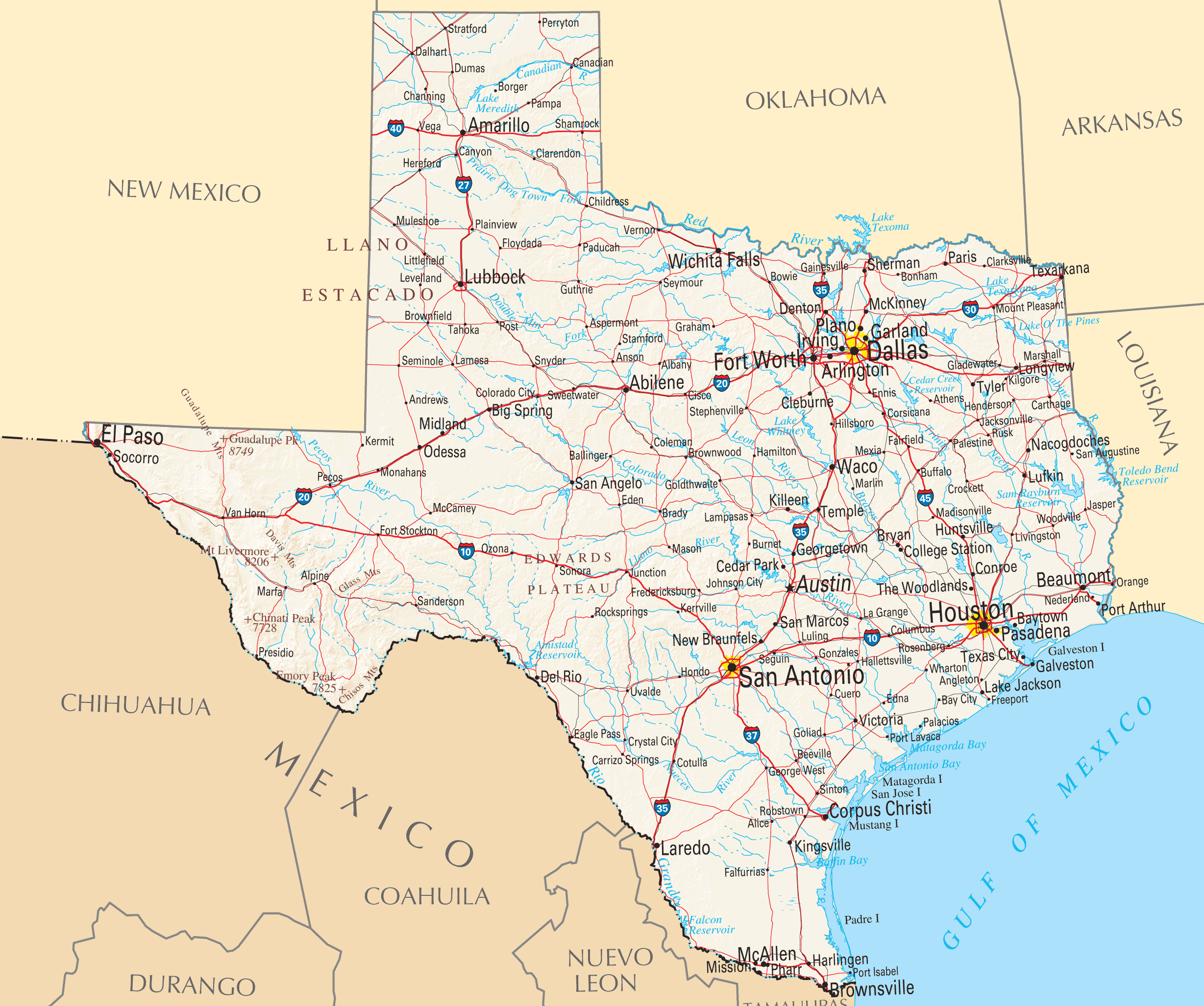
Map of Texas - Texas State Map

Texas Highway and Road Map (raster image version) - World ...

Physical Map of Texas - Ezilon Maps


0 Komentar untuk "Texas"