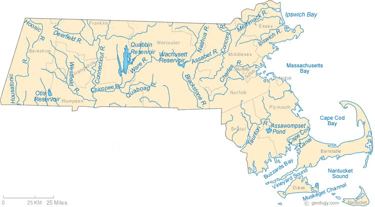
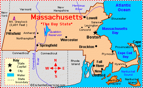
CIS: Maps of Massachusetts

Massachusetts Listeni/ˌmæsəˈtʃuːsᵻts/, officially the
Commonwealth of Massachusetts, is a state in the New England region of the
Northeastern United States. It is bordered by Rhode Island and Connecticut to
the south, New York to the west, Vermont and New Hampshire to the north, and
the Atlantic Ocean to the east. Massachusetts is the 7th smallest state by land
area, but the 15th most populous and the 3rd most densely populated of the 50
states. With an estimated 6.8 million residents in 2015,[9] it is the most
populous of the six New England states and has the nation's sixth highest GDP
per capita.[42] The capital of Massachusetts, as well as the state's largest
city, is Boston. The state features four separate metropolitan statistical
areas: the Boston-Cambridge-Quincy metropolitan area in the east, the Worcester
metropolitan area in the center, the Springfield metropolitan area in the west,
and the Barnstable metropolitan area in the southeast. Over 80% of
Massachusetts' population currently lives in the Greater Boston Combined
Statistical Area.[43]
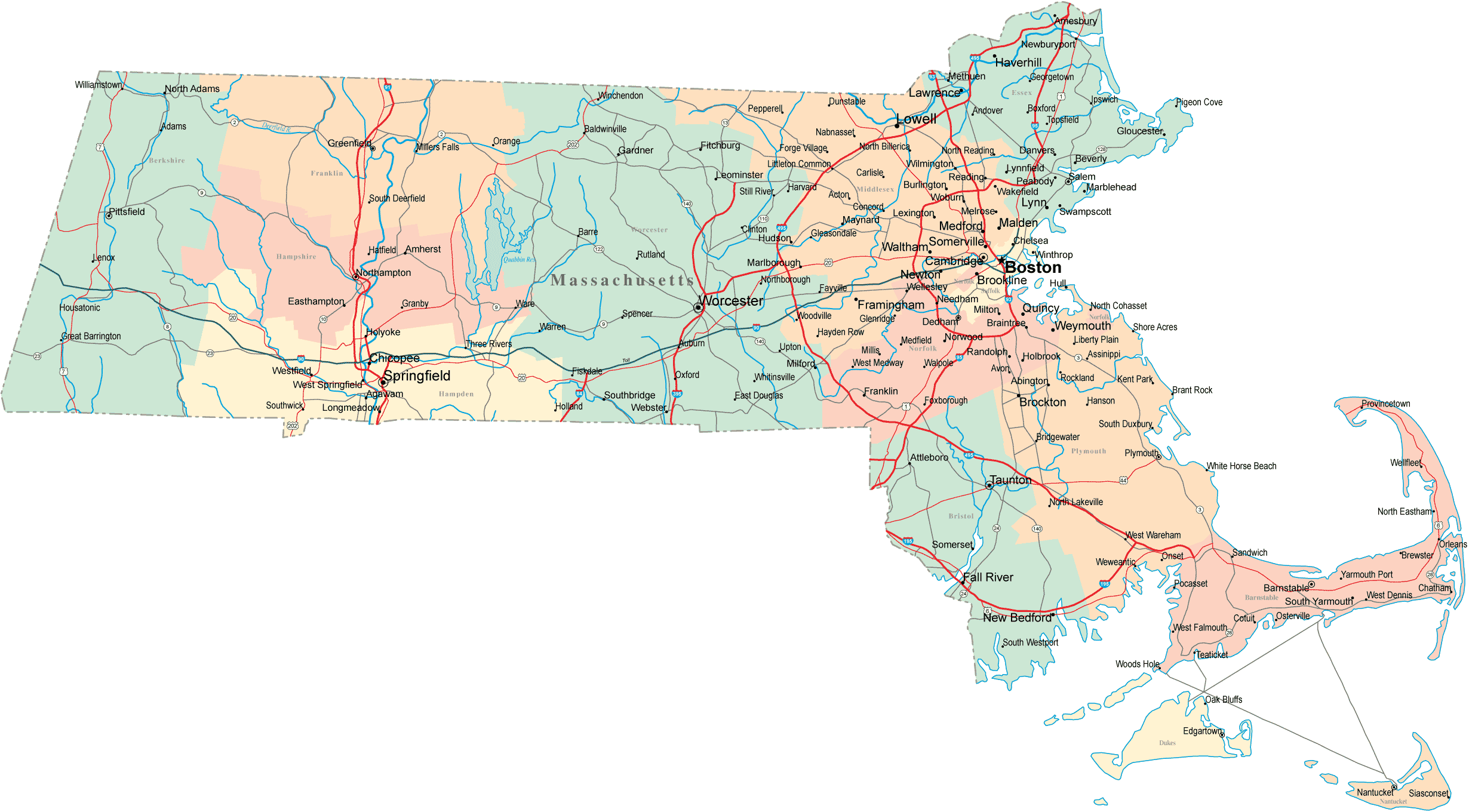
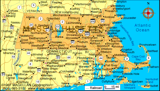
Map of Massachusetts Cities - Massachusetts Road Map

Massachusetts has played a significant historical, cultural, and commercial role in American history. Plymouth was the site of the first colony in New England, founded in 1620 by the Pilgrims, passengers of the Mayflower. Harvard University, founded in 1636, is the oldest institution of higher learning in the United States.[44] In 1692, the town of Salem and surrounding areas experienced one of America's most infamous cases of mass hysteria, the Salem witch trials.[45] In the 18th century, the Protestant First Great Awakening, which swept the Atlantic world, originated from the pulpit of Northampton, Massachusetts preacher Jonathan Edwards.[46] In the late 18th century, Boston became known as the "Cradle of Liberty"[47] for the agitation there that led to the American Revolution and the independence of the United States from Great Britain. In 1777, General Henry Knox founded the Springfield Armory, which during the Industrial Revolution catalyzed numerous important technological advances, including interchangeable parts.[48] In 1786, Shays' Rebellion, a populist revolt led by disaffected Revolutionary War veterans, influenced the United States Constitutional Convention.[49]
Before the American Civil War, Massachusetts was a center for the temperance,[50] transcendentalist,[51] and abolitionist movements.[52] In the late 19th century, the Olympic sports of basketball and volleyball were invented in the Western Massachusetts cities of Springfield and Holyoke, respectively.[53][54] In 2004, Massachusetts became the first U.S. state to legally recognize same-sex marriage as a result of the decision of the state's Supreme Judicial Court.[55] Massachusetts has contributed many prominent politicians to national service, including members of the Adams family and the Kennedy family.
Originally dependent on fishing, agriculture, and trade,[56] Massachusetts was transformed into a manufacturing center during the Industrial Revolution.[57] During the 20th century, Massachusetts' economy shifted from manufacturing to services.[58] In the 21st century, Massachusetts is an international economic leader in life science, the finance industry, biotechnology, information technology, manufacturing, renewable energy, the defense industry, and maritime trade.[59]
Massachusetts Road Map - MA Road Map - Massachusetts Highway Map
Map of Massachusetts
Massachusetts State Map

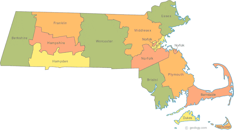
Massachusetts County Map

massachusetts-county-map.gif

Massachusetts Maps - Perry-Castañeda Map Collection - UT ...
Highway Map of Massachusetts - Aaccessmaps.com

Massachusetts Zip Code Maps - Free Massachusetts Zip Code Maps

Map of Massachusetts
800AgeInfo - Find Your Regional Elder Care Agency

Massachusetts: Facts, Map and State Symbols ...

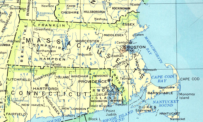
Atlas: Massachusetts
Reference Map of Massachusetts, USA - Nations Online Project

Massachusetts Map | Map of Massachusetts

Massachusetts Vector Adobe Illustrator Maps - Download 24/7 ...

Massachusetts Highway and Road Map (raster image version ...

Massachusetts Plant Hardiness Zone Map • Mapsof.net


0 Komentar untuk "Massachusetts"